
In September 1890 members of the Board of Public Works took a tour of the city. In the vicinity of Pico Boulevard, where Pearl met Figueroa, a discussion started about “opening Figueroa through.” The tour goers noted that the street stopped abruptly and claimed not to know “how it became obliterated and appropriated as private property.”[1]
The question of either opening or abandoning Figueroa from Pico to Sixth Street would take an additional four years of thinking and the work of at least three different city attorneys.[2] Many of the area’s early property owners assumed that at some point the street would run smoothly from north to south. Initially this was also the opinion of the city attorney who maintained the public’s claim to the land.[3] And yet, in December 1894, an ordinance abandoning the street was unanimously adopted by the city council.[4]
The confusion apparently stemmed from the various maps used by the city. In Hancock’s survey of 1853 the portion of Figueroa north of Pico was clearly laid out.[5] A second edition of the survey published in 1884 showed the street “crossed and cut up by private property lines”. However, the street was still “distinctly drawn to show that the rights of private parties were disputed”. Other maps either included the street or drew only those sections that had not been enclosed.[6]
As the likelihood of vacating Figueroa increased, the city council was “besieged with protests”.[7] Property owners sent petitions to the city clerk suggesting that their land would be cut off from the city around them and “greatly damaged” if any portion of the street were closed or abandoned.[8] In his letter to the city council, resident James B. Mitchell reminded the councilmen that when he bought the property, the published map of the city “showed the street as entirely unobstructed”. For Mitchell, the existence of this map “implied and guaranteed” the right-of-way and he suggested that he would not have bought the lots if he’d known that the street was disputed. [9]
In contrast, speaking for the supporters of abandonment, attorney Max Lowenthal (figure 1) suggested that the protesters had a moral, but not necessarily legal right to street access. He argued that they should not be driven from their land, but because the maps were not clear, homes and business had been built in the area and more people would be negatively affected by opening Figueroa.[10]
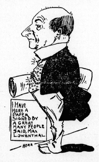
Figure 1: Attorney Max Lowenthal argues for the supporters of abandonment. Source: Los Angeles Herald
The risk averse council obviously agreed. In discussing their reasons to abandon the street, the council claimed that despite the existence of a map, the street was never laid out and for thirty years the land around it had “been in the possession and occupation of private individuals.” Confiscating the land at this point would lead to “prolonged litigation with every prospect of defeat.”[11] The dissatisfaction of a few was preferable to the lawsuits of the many and reality rather than cartography prevailed.
[1] “Public Works: A Tour of Inspection by the Board”, Los Angeles Times (1886-1922); Sep 19, 1890; ProQuest Historical Newspapers: Los Angeles Times (1881-1990), pg. 2
[2] “Figueroa Street” Los Angeles Herald, Volume 43, Number 43, Nov 23, 1894
[3] “Municipal Matters: The Extension of Figueroa Street Again Revived. A …” Los Angeles Times (1886-1922); Nov 22, 1891; ProQuest Historical Newspapers: Los Angeles Times (1881-1990), pg. 6
[4] “The Public Service: Another Meeting of the City Council”, Los Angeles Times (1886-1922); Dec 13, 1894; ProQuest Historical Newspapers: Los Angeles Times (1881-1990), pg. 10
[5] Hancock’s survey updated Lieutenant Ord’s original survey of 1849 and was used by real estate brokers to sell city lots http://www.davidrumsey.com/luna/servlet/detail/RUMSEY~8~1~2132~180050:Map-Of-The-City-Of-Los-Angeles-Show
[6] “Municipal Matters: The Extension of Figueroa Street Again Revived” Los Angeles Times (1886-1922); Nov 22, 1891; ProQuest Historical Newspapers: Los Angeles Times (1881-1990), pg. 6
[7] “Figueroa Street” Los Angeles Herald, Volume 43, Number 43, Nov 23, 1894
[8] Gould, Will D and Gould, Mary L “Figueroa Street: Petition Against Closing a Portion of That Thoroughfare” Los Angeles Times (1886-1922); Oct 16, 1893; ProQuest Historical Newspapers: Los Angeles Times (1881-1990), pg. 5; “The Public Service: Matters Talked of at the City Hall”. Los Angeles Times (1886-1922); Dec 9, 1894; ProQuest Historical Newspapers: Los Angeles Times (1881-1990), pg. 21
[9] “The Public Service: Matters Talked of at the City Hall”. Los Angeles Times (1886-1922); Dec 9, 1894; ProQuest Historical Newspapers: Los Angeles Times (1881-1990), pg. 21
[10] “Figueroa Street.: Ownership between Sixth and Pico. A Protest Against …” Los Angeles Times (1886-1922); Nov 20, 1894; ProQuest Historical Newspapers: Los Angeles Times (1881-1990), pg. 10
[11] “The Public Service: Another Meeting of the City Council”, Los Angeles Times (1886-1922); Dec 13, 1894; ProQuest Historical Newspapers: Los Angeles Times (1881-1990), pg. 10
